-

Garmin
Garmin AIRMAR B60 Thru Hull Transducer
This entry-level tilted bronze transducer accommodates deadrise angles of 16 to 24 degrees without a fairing. An excellent choice for fiberglass and wood hulls, this 600 W 8-pin transducer has a depth of 800 to 1,200 ft; an operating frequency of 50 to...
-

Garmin
Garmin AIRMAR B75H Thru Hull Transducer
This bronze thru-hull mount transducer is designed to allow both traditional and spread spectrum scanning when used with a compatible sonar. Depth and temperature transducer. A 600 W transducer with 8 pins, it has a depth of 800 ft; an operating...
-

Garmin
Garmin AIRMAR SS60 Thru Hull Transducer
This stainless steel 600 W 8-pin transducer provides a vertical beam without a fairing and is excellent for fiberglass and wood hulls. It has a depth of 800 to 1,200 ft; an operating frequency of 50 to 200 kHz; a beamwidth of 45/12 degrees; and an 8 to...
-

Garmin
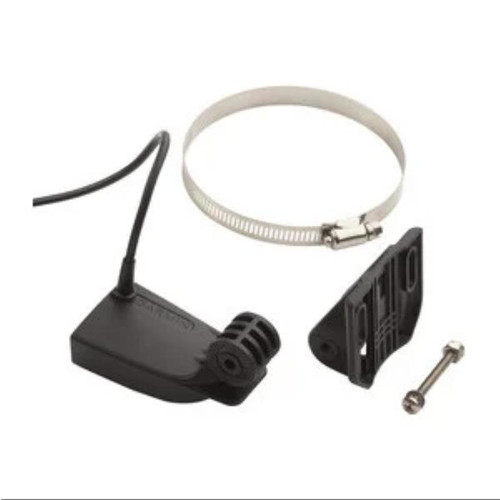
Garmin GT8HW-TM Transom Mount Transducer
GT8HW-TM transducer is perfect for shallow water fishermen who want clear bottom definition under the boat as well as crisp, clear and wide fish arches with excellent target separation. The wider beam width — up to 24 degree beam angle —...
-

Garmin
Garmin 4-pin Transducer Extension Cable
Connect your 4-pin transducer to your sonar unit with this 10 ft (3 m) extension cable.
-

Garmin
Garmin 4-pin Female to 5-pin Male NMEA 2000 Adapter Cable 6ft
Connect your compatible echoMAP CHIRP or ECHOMAP Plus chartplotter/sounder combo to a NMEA 2000 network with this 6 foot (2 meters) adapter cable.
-

Garmin
Garmin Sun Cover For GPSMAP G3 Series
Protect your compatible marine device from scratches and the sun when not in use. This protective cover fits snugly over the display to avoid exposure.
-

Garmin
Garmin Transducer Adapter Cable (P72/P79/GT15/GT30)
Combine a Garmin transom mount scanning transducer with a Garmin or Airmar in-hull mounted transducer. Use this Y-cable to connect a 12-pin SideVü/Clearvü-only transducer along with an 8-pin 2D-only transducer into a single 12-pin (orange)...
-

Garmin
Garmin Trim Piece Snap Cover For GPSMAP G3 Series
Don't let misplaced or broken trim blemish the beauty of your Garmin. Use this trim piece snap cover and mount your compatible GPSMAP marine device.
-

Garmin
Garmin Sun Cover For Protective Cover GPSMAP PLUS Series
Protect your compatible marine device from the sun and scratches when not in use. This protective cover fits snugly over the display to avoid exposure.
-

Garmin
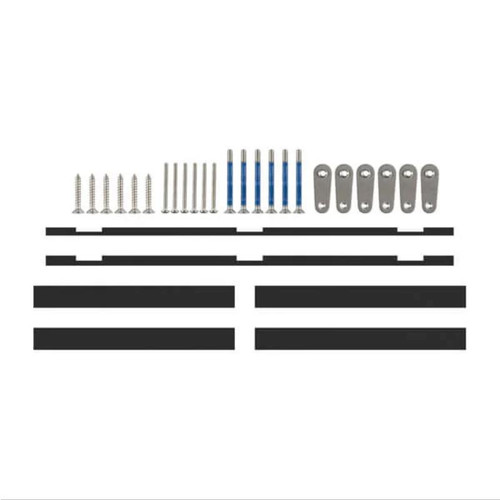
Garmin Flush Mount Kit For GPSMAP G3 Series
Looking for a sleeker installation of your compatible Garmin device? Our flush mount kit allows you to easily position your marine device against most flat surfaces in your boat. The kit includes hardware, installation instructions and a template
-

Garmin
Garmin Replacement Bail Mount Bracket With Knobs For GPSMAP G3 Series
Surface mount your compatible GPSMAP device using our bail mount with knobs. The mount tilts for optimum viewing.
-

Garmin
Garmin Flush Mount Kit For GPSMAP PLUS Series
Looking for a sleeker installation of your compatible Garmin device? Our flush mount kit allows you to easily position your marine device against most flat surfaces in your boat. The kit includes hardware, installation instructions and a template.
-

Garmin
Garmin Trim Piece Snap Cover For GPSMAP PLUS Series
Don't let misplaced or broken trim blemish the beauty of your Garmin. Use this trim piece snap cover and mount your compatible GPSMAP device.
-

Garmin
Garmin SD Card Door For GPSMAP PLUS Series 12 inch
Secure and protect the memory card in your compatible marine device with this SD door.
-

Garmin
Garmin GC 200 Marine IP Camera
Enjoy added security and awareness on your vessel Use to monitor 1 or multiple areas above and below deck in clear, real-time HD video HD resolution for excellent quality images, even in low light Stream video from up to 4 cameras at a time on a...
-

Garmin
Garmin Power Cable For GPSMAP
Power and connect your compatible GPSMAP device with this 6-foot, 8-pin power/data cable. Use with NMEA 0183 devices and a lamp or horn for visible or audible alerts.
-

Garmin
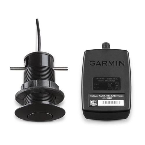
Garmin GDT 43 Depth and Temperature Transducer
This thru-hull transducer can read water depth and water temperature. It can retrofit an existing Nexus and Silva 43 mm thru-hull transducer (TH43). When bundled with the NMEA 2000 adapter, the GDT 43 can connect directly to the NMEA 2000 network,...
-

Garmin
Garmin GDT 43 Depth and Temperature Transducer (NMEA 2000)
Garmin GDT 43 Depth and Temperature Transducer (NMEA 2000) This thru-hull transducer can read water depth and water temperature. It can retrofit an existing Nexus and Silva 43 mm thru-hull transducer (TH43). Bundled with the NMEA 2000 adapter, the GDT 43...
-

Garmin
Garmin GST 43 Thru-Hull Speed/Temperature Transducer with GST 10 Bundle
The GST 43 is a thru-hull transducer that can read water speed and temperature. The transducer can retrofit an existing Nexus 43mm thru-hull transducer (TH43). Bundled with the GST 10, the GST 43 can connect directly to the NMEA 2000 network, and...
Marine Electronics
Marine electronics are a vital part of any boat, providing navigation, communication, and entertainment. The most common marine electronics include:
- GPS/Chartplotter: This is a device that uses satellite signals to determine your boat's position and display it on a map. Chartplotters also typically have features for planning routes, calculating distances, and viewing weather forecasts.
- Multifunction Display (MFD): An MFD is a type of chartplotter that also integrates other marine electronics, such as radar, fishfinder, and engine monitoring. This makes it a more versatile and convenient way to view all of your boat's data.
- Engine Monitor: This device displays information about your boat's engine, such as RPM, fuel level, and temperature. This information can be helpful for troubleshooting problems and ensuring that your engine is running properly.
- Depth Sounder/Fishfinder: This device uses sonar to measure the depth of the water and locate fish. It is a valuable tool for both safety and fishing.
- VHF Radio: This is a radio that uses VHF frequencies to communicate with other boats and shore stations. It is an essential piece of safety equipment, as it can be used to call for help in an emergency.
- Wi-Fi and Cellular Range Boosters: These devices can extend the range of your boat's Wi-Fi and cellular signal, allowing you to stay connected even when you are far from shore.
- Battery Monitoring System: This device tracks the health of your boat's batteries, providing information such as voltage, current, and temperature. This information can be helpful for preventing battery problems.
- AIS: AIS stands for Automatic Identification System. It is a system that allows boats to transmit their position, course, and speed to other boats and shore stations. This information can be used to avoid collisions and improve situational awareness.
These are just some of the most common marine electronics. The specific electronics that you need on your boat will depend on your needs and budget. However, even a basic set of marine electronics can make your boating experience safer and more enjoyable.
Here are some additional tips for choosing marine electronics:
- Consider the size of your boat and the features that you need.
- Choose a reputable brand.
- Make sure that the electronics are compatible with each other.
- Have the electronics professionally installed.
- Keep the electronics clean and well-maintained.
With careful planning and installation, your marine electronics can provide years of reliable service.


