-

Garmin
Garmin Marine network cable, RJ45 40 ft (12.19 m)
Garmin marine network cables offer additional cable lengths to help with install. Various sizes sold separately.
-
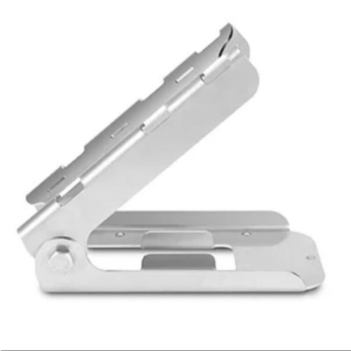
Garmin
Garmin Trolling Motor Mount Kit (Panoptix PS31)
Easily attach your Panoptix PS31 Forward Transducer to the shaft or barrel of your boat’s trolling motor with this stainless steel mount. Kit includes trolling motor mount brackets and hardware.
-
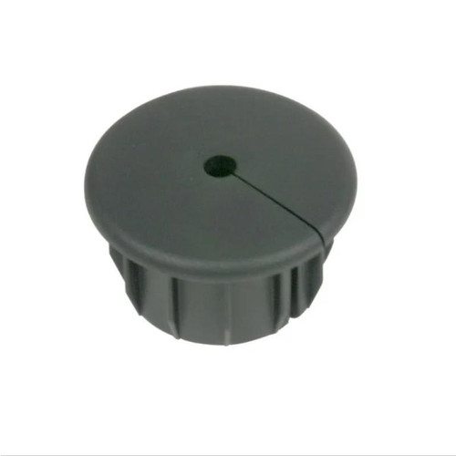
Garmin
Garmin Cable Grommets
Use Garmin cable grommets to cover installation holes that have been drilled into your boat.
-
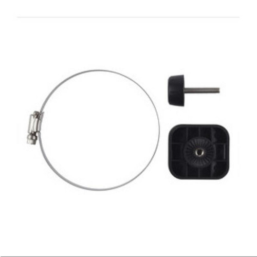
Garmin
Garmin Trolling Motor Barrel Mount
Mount a Panoptix transducer on the barrel of your trolling motor with this kit. It features molded teeth for ultimate adjustability and fits all barrel diameters, including those on popular Minn Kota and MotorGuide trolling motors.
-
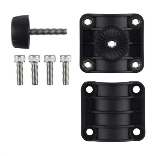
Garmin
Garmin Trolling Motor Shaft Mount
Mount a Panoptix transducer on the shaft of your trolling motor with this kit. I t's adjustable design fits all shaft diameters, including those on popular Minn Kota and MotorGuide trolling motors.
-

Garmin
Garmin Transom Mount Kit (Panoptix PS30)
Easily attach your Panoptix PS30 Down Transducer to the transom of your boat with this stainless steel mount. Kit includes transom mount brackets and hardware.
-
Garmin
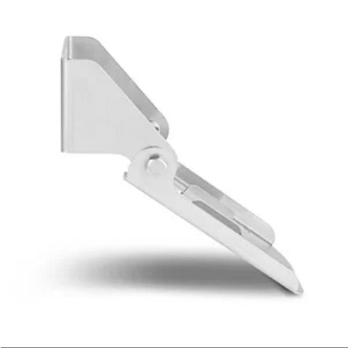
Garmin Transom Mount Kit (Panoptix PS31)
Easily attach your Panoptix PS31 Forward Transducer to the transom of your boat with this stainless steel mount. Kit includes transom mount brackets and hardware. Please note: The forward-facing transom mount transducer should be mounted in a...
-

Garmin
Garmin GT56UHD-TM Transducer 12pin
LESS TIME FINDING. MORE TIME FISHING. This all-in-one transducer offers ultimate versatility, featuring Ultra High-Definition ClearVü and SideVü scanning sonars, high wide CHIRP traditional sonar and more, so you can spend more time catching...
-

Blue Sea Systems
Cable Clam 8mm Cable Including Stainless Steel Cover
Cable Clam 8mm Cable Including Stainless Steel Cover Provides a waterproof pass-through for antenna cables without requiring removal of the factory installed connector Save the expense of removing and replacing connectors Avoid poor connections from...
-

Handheld Remote Control - 2 Channel Kompass Radio
Handheld Remote Control 2 Channel Kompass Radio Controller designed for direct applications to command winches, gangways, etc. Waterproof rating of IP56 with a rubber soft grip. Casing made out of self extinguishing polyester resin...
-

Raymarine
Raymarine Tacktick Micro Compass System with Strap Bracket T061
The Tacktick Raymarine Micro Compass proves a huge advantage over competitors using glass ball compasses. To win races you must react to even small wind shifts. Readable, precise and reliable heading information from you compass is critical. Digital...
-

Raymarine
Raymarine Tacktick Micro Compass T060
The Tacktick Raymarine Micro Compass proves a huge advantage over competitors using glass ball compasses. To win races you must react to even small wind shifts. Readable, precise and reliable heading information from you compass is critical. Digital...
-

CMS Connection Lead "C" Style
CMS Electracom manufacture a range of DIY power points and cables that can be soft wired together. CMS products allow the DIY builder to fit many of the 240V cables and power points into the walls of the Motorhome or Caravan during construction, and...
-

TBS Electronics
TBS Communication Kit - USB Connection
TBS Communication Kit - USB Connection. TBS PC Communication Kit to Suit Enerdrive ePRO monitors, includes bundled software. Allows recording of all parameters including temperature (via additional temp sensor) - USB Connection Part...
-

-
CZone Digital Switching
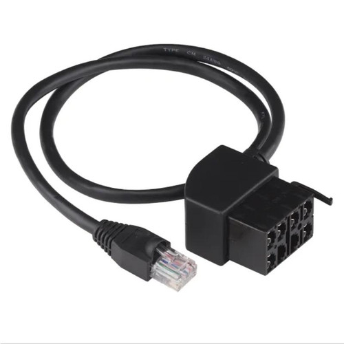
CZone SCI Cable Assembly Contura
CZone SCI Cable Assembly Contura. SCI cable to suit Push Buttons Part NumberLength CZO-CZ-80-911-0018-00 0.5m CZO-CZ-80-911-0021-00 3.0m
-

CZone Digital Switching
CZone NMEA 2000 Extension
Carries power and data along backbone to NMEA 2000 devices Part NumberLength CZO-CZ-80-911-0026-00 0.5m CZO-CZ-80-911-0027-00 2.0m CZO-CZ-80-911-0024-00 5.0m CZO-CZ-80-911-0025-00 10.0m
-

CZone Digital Switching
CZone NMEA 2000 Power Cable - 1m
Carries power and data along backbone to NMEA 2000 devices Part Number Length CZO-CZ-80-911-0028-00 1m
-

CZone Digital Switching
CZone NMEA 2000 Single Tee Connector
CZONE NMEA 2000 Single Tee Connector Connects multiple devices into the NMEA backbone Part Number CZO-CZ-80-911-0029-00
-

CZone Digital Switching
CZone NMEA 2000 2-Way Tee Connector
CZONE NMEA 2000 2-Way Tee Connector Connects multiple devices into the NMEA backbone Part Number CZO-CZ-80-911-0047-00
Marine Electronics
Marine electronics are a vital part of any boat, providing navigation, communication, and entertainment. The most common marine electronics include:
- GPS/Chartplotter: This is a device that uses satellite signals to determine your boat's position and display it on a map. Chartplotters also typically have features for planning routes, calculating distances, and viewing weather forecasts.
- Multifunction Display (MFD): An MFD is a type of chartplotter that also integrates other marine electronics, such as radar, fishfinder, and engine monitoring. This makes it a more versatile and convenient way to view all of your boat's data.
- Engine Monitor: This device displays information about your boat's engine, such as RPM, fuel level, and temperature. This information can be helpful for troubleshooting problems and ensuring that your engine is running properly.
- Depth Sounder/Fishfinder: This device uses sonar to measure the depth of the water and locate fish. It is a valuable tool for both safety and fishing.
- VHF Radio: This is a radio that uses VHF frequencies to communicate with other boats and shore stations. It is an essential piece of safety equipment, as it can be used to call for help in an emergency.
- Wi-Fi and Cellular Range Boosters: These devices can extend the range of your boat's Wi-Fi and cellular signal, allowing you to stay connected even when you are far from shore.
- Battery Monitoring System: This device tracks the health of your boat's batteries, providing information such as voltage, current, and temperature. This information can be helpful for preventing battery problems.
- AIS: AIS stands for Automatic Identification System. It is a system that allows boats to transmit their position, course, and speed to other boats and shore stations. This information can be used to avoid collisions and improve situational awareness.
These are just some of the most common marine electronics. The specific electronics that you need on your boat will depend on your needs and budget. However, even a basic set of marine electronics can make your boating experience safer and more enjoyable.
Here are some additional tips for choosing marine electronics:
- Consider the size of your boat and the features that you need.
- Choose a reputable brand.
- Make sure that the electronics are compatible with each other.
- Have the electronics professionally installed.
- Keep the electronics clean and well-maintained.
With careful planning and installation, your marine electronics can provide years of reliable service.


