-

Garmin
Garmin Reactor 40 Steer-by-wire Corepack for Viking VIPER With GHC 50 Autopilot Instrument
Garmin Reactor 40 Steer-by-wire Corepack for Viking VIPER With GHC 50 Autopilot Instrument Designed for Viking yachts with a Viking VIPER steering system, this Reactor 40 autopilot steer-by-wire corepack gives you the extra hand you need, so you can...
-

Garmin
Garmin Reactor 40 Steer-by-wire Corepack for Volvo-Penta With GHC 50 Autopilot Instrument
Garmin Reactor 40 Steer-by-wire Corepack for Volvo-Penta With GHC 50 Autopilot Instrument Designed for yachts with a Volvo Penta system, this Reactor 40 autopilot steer-by-wire corepack gives you the extra hand you need, so you can explore paradise...
-

Garmin
Garmin Compact Reactor 40 Hydraulic Autopilot with GHC 50 Instrument Pack With GHC 50 Autopilot Instrument
Garmin Compact Reactor 40 Hydraulic Autopilot with GHC 50 Instrument Pack With GHC 50 Autopilot Instrument Designed for boats less than 25' long, this entry-level, Compact Reactor 40 hydraulic autopilot gives you the extra hand you need, so you can...
-

Garmin
Garmin Compact Reactor 40 Hydraulic Autopilot with GHC 50 and Shadow Drive Technology Pack
Garmin Compact Reactor 40 Hydraulic Autopilot with GHC 50 and Shadow Drive Technology Pack Designed for boats less than 25' long, this entry-level, Compact Reactor 40 hydraulic autopilot gives you the extra hand you need, so you can explore paradise...
-
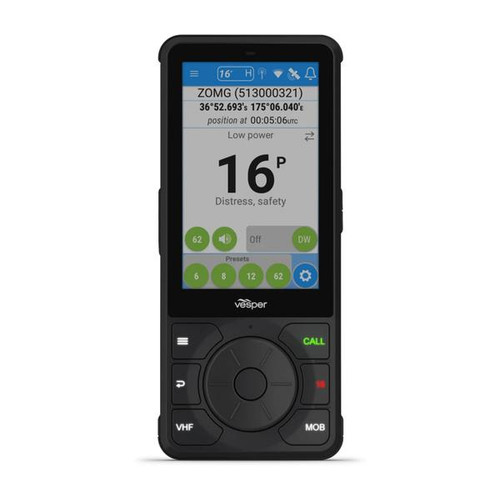
Vesper
Vesper Cortex H1P Portable Handset
Vesper Cortex H1P Portable Handset Available in tethered and portable versions, Cortex touchscreen handsets are the ultimate interface for your Cortex system. They put the best in VHF communications and AIS situational awareness right at your fingertips...
-

Garmin
Garmin GST 43 Thru-hull Speed/Temperature Transducer without GST 10
Garmin GST 43 Thru-hull Speed/Temperature Transducer without GST 10 The GST 43 is a thru-hull transducer that can read water speed and temperature. The transducer can retrofit an existing Nexus 43mm thru-hull transducer (TH43). Bundled with the GST 10,...
-

Garmin
Garmin Dual Beam Transducer - Transom Mount (4-pin)
Garmin Dual Beam Transducer - Transom Mount (4-pin) This dual beam transducer replaces the one included with your echo™ or STRIKER™ series fishfinder. A 500 W 4-pin transducer, it has an operating frequency of 77/200 kHz; a beamwidth of 45/15...
-

Garmin
Garmin Dual Frequency 8-pin Connector
Garmin Dual Frequency 8-pin Connector This plastic transom mount can be used to replace the dual frequency transducers included with many Garmin units. The 500W 8-pin transducer has a maximum depth of 1,500 ft; an operating frequency of 50 to 200...
-

Garmin
Garmin Power/Data Cable
Garmin Power/Data Cable Garmin's power and data cable may be used for lengthy cable runs. Cable has a 7 pin/bare wire termination. Part Number GMN-010-10781-00
-
-

Oceansouth
Winch Cover - Grey, Self-Tailing
Keep salt, UV and other substances off your valuable winches with grey Oceansouth self-tailing winch covers. Manufactured with 100% Dope dyed polyester ATLAS canvas. Colour fastness to Light Grade 8 ensures the extended life of your...
-

Oceansouth
Winch Cover - Grey, Standard
Keep salt, UV and other substances off your valuable winches with grey Oceansouth standard winch covers. Manufactured with 100% Dope dyed polyester ATLAS canvas. Colour fastness to Light Grade 8 ensures the extended life of your...
-

Oceansouth
Oceansouth Bimini Cover - 4 Bow Stainless Steel
A strong 4-Bow bimini cover from Oceansouth with stainless steel frame, this boat canopy is ideal for open boats and features a unique integrated storage cover for protection while towing and when the cover is not in use. Manufactured from ATLAS™...
-

Oceansouth
Oceansouth Skipper Folding Boat Seat
Oceansouth's foldable "Skipper" seat is made from a high-impact, UV-treated polymer and is available in 5 styles. Deluxe model with a stylish high back. Seat Dimensions: Height: 46...
-
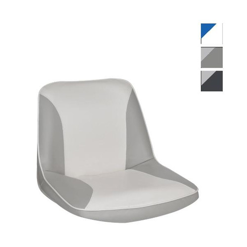
Oceansouth
Oceansouth C-Seat
Oceansouth's classic moulded C-Seat follows the contours of the body. Comfortable and durable. Moulded in High – impact UV treated polymer. Professionally upholstered. UV resistant fabric by OMNOVA. Two tone upholstered with back storage...
-
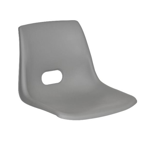
Oceansouth
Oceansouth C-Seat - Shell Only
Oceansouth's classic moulded C-Seat follows the contours of the body. Comfortable & durable Moulded in high-impact UV treated polymer Suits standard 7" swivels or the Titan swivel Part Number OCS-MA701
-

Oceansouth
Oceansouth Bimini Cover - 3 Bow Stainless Steel
A strong 3-Bow bimini cover from Oceansouth with stainless steel frame, this boat canopy is ideal for open boats, runabouts & inflatables. It features a unique integrated storage cover for protection while towing and when the cover is not in use...
-
Oceansouth
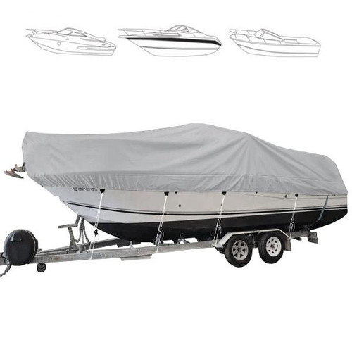
Oceansouth Runabout Cruiser Cover - Inboard Engine
Oceansouth boat cover designed to fit large runabout cruiser type boats with an inboard engine. Suitable for boats with bow rails up to 150mm high and a windscreen up to 600mm height. Trailerable, high-quality cover Quality ATLAS fabric with a 7...
-
Oceansouth
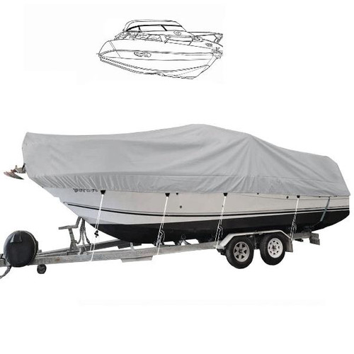
Oceansouth Runabout Cruiser Cover - Outboard Engine
Oceansouth boat cover designed to fit large runabout cruiser type boats with an outboard engine. Suitable for boats with bow rails up to 500mm high and a windscreen up to 600mm height. Trailerable, high-quality cover Quality ATLAS fabric with a 7...
-

Oceansouth
Oceansouth Bow Rider Cruiser Cover - Inboard Engine
Oceansouth boat cover designed to fit large bowrider type boats with an inboard engine. Suitable for boats with bow rails up to 150mm high and a windscreen up to 600mm height. Trailerable, high-quality cover Quality ATLAS fabric with a 7 Year life...
Unit 15, 20 Narabang Way Belrose NSW 2085 AUSTRALIA ABN: 72 626 908 585
- 02 8015 2416
-
Login | My Account
New Customer
Registering provides you with personalized services, including: wish list, order status and promotions.
Register - Gift Certificates
- Store Info


