Garmin Navionics Platinum+ Mexico, Caribbean to Brazil - Inland & Coastal Marine Charts
A comprehensive, all-in-one solution, Navionics+ charts and maps combine clear, reliable coastal/inland content with advanced guidance features and compatibility with a wide range of chartplotter brands.
- Navigate with our best offshore and inland lake coverage for your compatible chartplotter1
- See it your way. Customise your view with various chart layers and overlay combinations.
- With your included 1-year subscription, access daily updates via the Navionics® chart installer software.
- Advanced route guidance technology2 lets you navigate with suggested dock-to-dock routings.
- Selectable map options let you highlight shallow areas, adjust contour density or select a fishing range.
- Save money while continuing to access daily updates plus new content downloads by renewing your subscription
ALL-IN-ONE MAP SOLUTION
- Access detail-rich mapping of coastal features, lakes, rivers and more on a wide range of compatible chartplotters. Integrated coastal and inland lake content offers coverage for boaters worldwide.
DAILY CHART UPDATES
- Charts are constantly being enhanced with new and amended content — thousands of updates are made every day. The included 1-year subscription gives you access to daily chart updates via the Navionics chart installer software.
DOCK-TO-DOCK ROUTE GUIDANCE
- Advanced route guidance technology2 uses your boat settings, along with chart data and frequently traveled routes, to calculate a suggested path to follow from dock to dock.
UP TO 0.5 M CONTOURS
- For improved fishing and navigation, up to 0,5 m contours provide a clear depiction of bottom structure for fishing charts as well as enhanced detail in swamps, canals, harbours, marinas and more.
ADVANCED MAP OPTIONS
- Change the way you view Navionics charts to focus on the details that matter most to you. Highlight shallow areas, adjust contour density, or select a fishing range.
COMMUNITY EDITS
- Download community edits for useful local knowledge added by users of the Navionics Boating app, and view the data on your compatible chartplotter.
PLOTTER SYNC
- Transfer routes and markers, update charts and more between your plotter card and mobile app — wirelessly. You can even activate or renew your cartography subscription and upload sonar logs4.
SONARCHART™ LIVE MAPPING
- Create your own maps on the fly. Watch new 1’ HD bathymetry maps develop in real time as your boat moves through the water.
RELIEF SHADING
- This downloadable shading feature5 combines color and shadow to give you an easy-to-interpret, clearer view of bottom structure than contour lines alone.
HIGH-RESOLUTION SATELLITE IMAGERY
- Downloadable high-resolution satellite imagery5 provides a realistic view of your surroundings — ideal for entering unfamiliar harbors or ports.
AERIAL PHOTOGRAPHY
- Crystal-clear aerial and surface photos of ports, marinas, bridges, docks, boat ramps, dams and navigational landmarks provide a better sense of your surroundings above the waterline.
3D VIEW
- Unique 3D views provide additional perspective, both above and below the water’s surface, to highlight key features and aid in situational awareness.
COVERAGE:
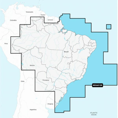
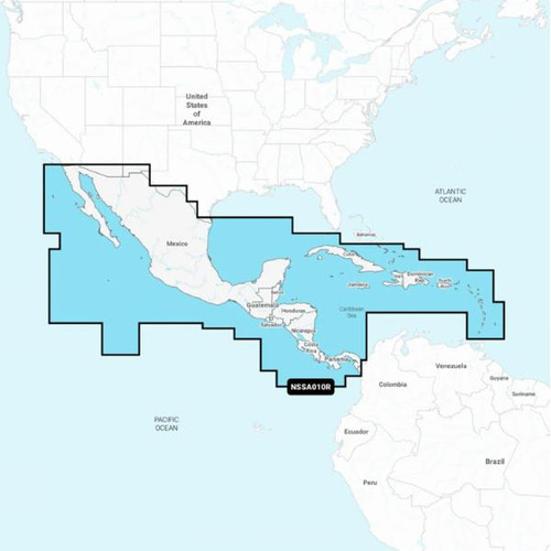
- Coastal coverage of Mexico, Central America and Brazil. Coverage includes the US Gulf Coast and the eastern US coast to Savannah, GA; Bermuda; the Bahamas; Cuba; Hispaniola; Puerto Rico and the Virgin Islands; the Windward and Leeward Islands; Jamaica; the Panama Canal, the western coast of South America to Arica, Chile; the Galapagos Islands; the Revillagigedo Islands; the Ilha Fernando de Noronha; the Saint Peter and Saint Paul Archipelago and the Rocas Atoll.
| Part Number |
|---|
| GMN-010-C1364-40 |


